Better late than never, I guess….

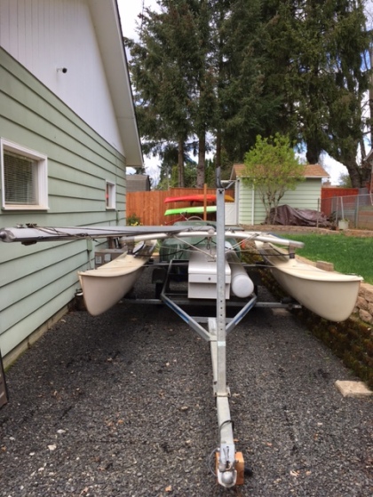
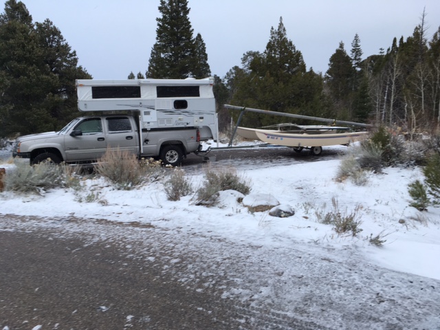
Last September (9/6-9/10) Chris and I took the Hobie out for a spin. For those of you just joining us, we acquired the Hobie from my parents last spring.  Before we bought the 5th wheel we had hopes of living aboard a boat.  The 5th wheel ended up being more practical.  The Hobie is a good test to see if sailing is our bag and then maybe someday we can sail the world!

HOBIE1.jpg

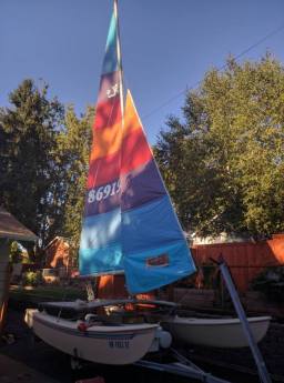
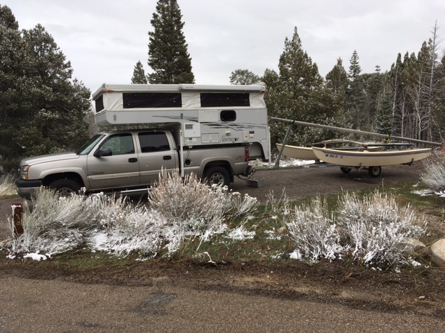
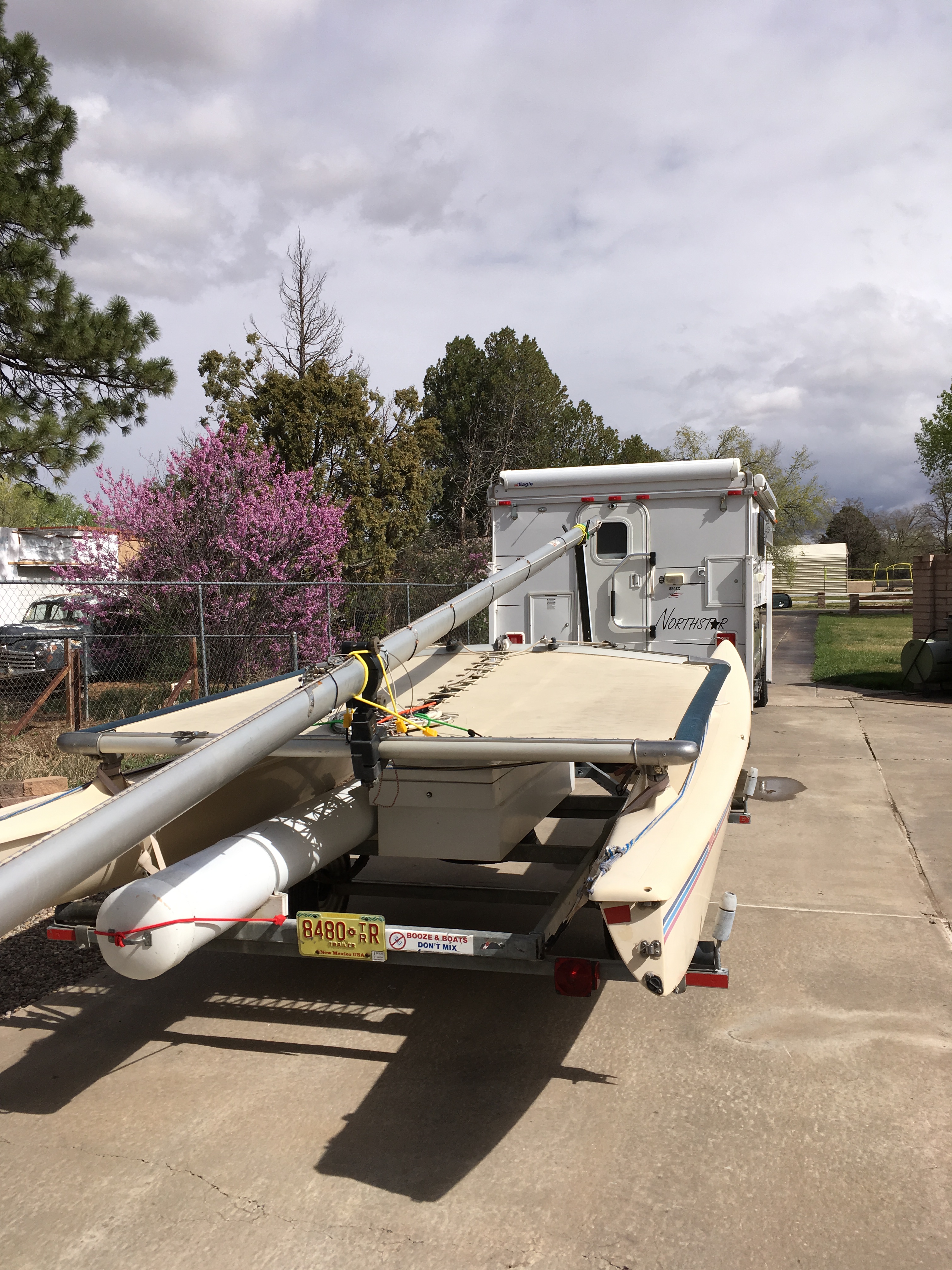
Hobie in the front yard

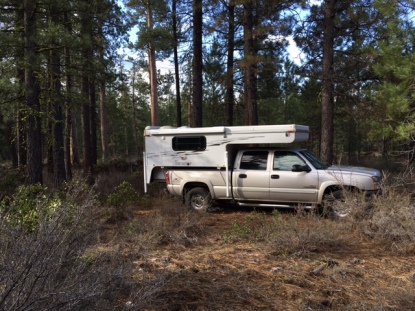
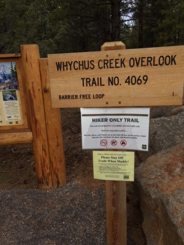
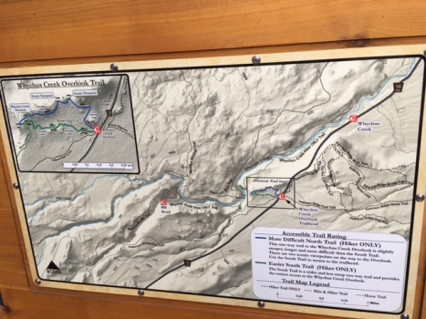
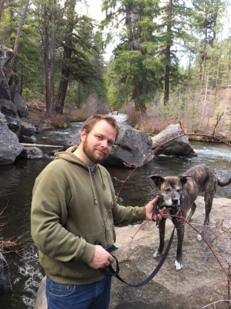
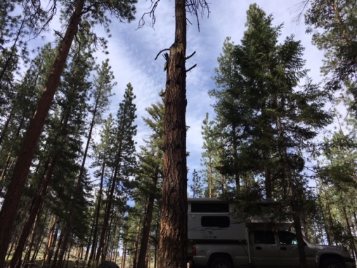
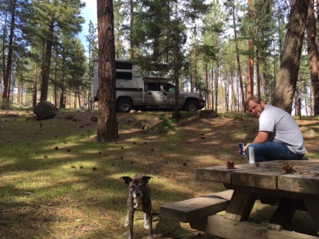
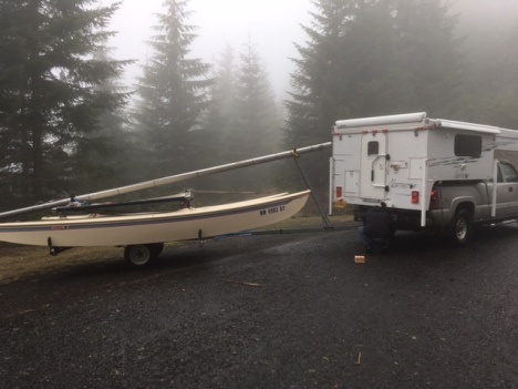
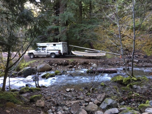
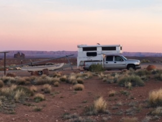
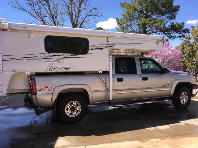
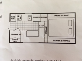
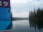
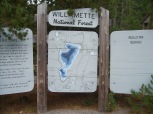
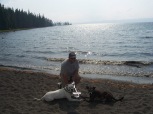
Waldo Lake was our lake of choice. To get there we took I-5 South to Eugene. Then just south of Springfield we took OR-58 east to NF-5897 North.  I towed the Hobie with the 4Runner and Chris took the truck with the camper.  We each took a dog so we wouldn’t be lonely. We arrived at North Waldo Campground around 11:30. And pretty much had our pick of sites, but chose one (site 52) over looking the boat ramp. We took two vehicles because we had to get back to work at Silver Falls State Park on Friday.  The life of a park ranger…

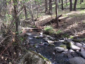
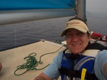
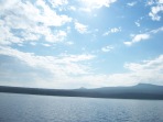
Waldo lake is a beautiful, but cold  and very clear blue lake.

100_1420.JPG  100_1422.JPG  100_1433.JPG   100_1431.JPG    100_1430.JPG  100_1426.JPG  100_1441.JPG    100_1439.JPG  100_1438.JPG  100_1424.JPG  100_1427.JPG


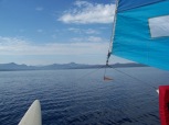
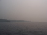
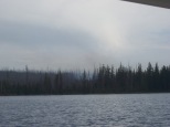
Despite the wildfire nearby,  the difficulties launching from the dock, having to drop the sails on the water and all the trial and error in between it was a good maiden voyage.

I spent the better part of my life on that boat, but it took a while to get a hang of things.  Turns out, Chris is a really great captain and I’m happy with being the crew.


Posted in Adventures so far, Uncategorized | Tagged , , , | Leave a comment

What’s in a name…

I can’t change the domain name without making a brand new blog, but I’ve long since thought pikeypair didn’t fit our trio (The travels and adventures of Laura, Chris and Ally). So I thought about pikeytrio or the pikeythree, but I just couldn’t think of anything really catchy.  That is, until last night!  I think that I do my best thinking when I can’t sleep…except when I don’t remember the good idea the next morning. Have you ever tried to write something down in the dark, saying “yeah this is a great idea” and then can’t read your handwriting in the morning?!

Anyways, I’m unofficially changing pikeypair to DRUM ROLL PLEASE…..

PikeyPairSquared

Now I know that some of you are thinking “uhm doesn’t a pair squared equal four?” You are correct! Well people we are now a quartet.  This new addition weighs about 60 lbs has four legs and a tail. That’s right you guessed it- a dag! Everyone, meet Buddy Damus. (short for Nostradamus).

IMG_1661.JPG

Here is Buddy at the dog shelter saying “pick me!”

He loved us and we loved him right from the start.  As as luck would have it so did Ally!

IMG_1677.JPG

Like two peas in a pod

IMG_1676.JPG

Buddy D. and Ally G. getting belly rubs

Buddy D. has settled in quite nicely as you can see. And that was only day 2.

The best dags are pound puppies. Don’t you agree?!

We are all ready for our next pikey adventure, maybe Memorial Day weekend.

Posted in Routine Posts | Tagged , , , | 1 Comment

Plan B…Plan C

April 21 – 23

To celebrate Chris taking the Professional Engineers Exam (PE), we decided to take the camper out! I set out to research a free or reasonably priced campground with hiking nearby.  My research led me to Siuslaw National Forest near Hebo, Oregon.  The options were Hebo Lake Campground and Mt. Hebo campground and South Lake dispersed area. The Pioneer-Indian Trail head #1300 and South Lake to summit Mt. Hebo seemed to fit the bill.

We live in Oregon right?! and it sometimes rains in Oregon right?! Well onto to Plan B: It must be 1-2 hours away and no rain….. Pretty tall order.

Mt. Hebo would have to wait.

Sisters, Oregon

April 21 – 22

After Chris finished his test, we set out for Indian Ford Campground in the Deschutes National Forest.  Knowing full well that the Indian Ford Campground would be closed for the season, we hoped to find a spot in the forest.  We took hwy 22 to hwy 20 to Forest Road 11 (Green Ridge Road) and drove until we saw something interesting.  At Forest Road 1105 we turned left. I guess we found something interesting, but not really. We took spot that was fairly level, raised the roof and went to sleep hoping that maybe we’d find something really interesting the next day.

IMG_1543.JPG

Ponderosa Pine forest

Those fire loving, Abert Squirrel living, vanilla smelling trees I have been known to hug from time to time.  I love me some Ponderosa Pine!  Sorry, I can’t always control my nerd.

This spot was so close to Green Ridge Road that we could see and hear traffic, but hey it was free.

April 22 – 23

The morning of Earth Day we set out to find a trail head and a more fascinating campsite for the night. After looking at the map we just knew that hwy 16 was going to have the site of our dreams. We found that 16 met up with many forest roads and unfortunately not one had anything that tickled our fancy.  In general, it appears that camping in the woods just north or south of Sisters is not a possibility.  There are plenty of camp grounds, but all are closed for the season.  Good news, though, Whychus Trailhead located directly off of 16 was the trail we were looking for.

IMG_1550.JPG

IMG_1551.JPG

IMG_1562.JPG

After a 6 mile round trip filled with a waterfall, river, rocks, 420 spray paint from 1996, skunk fur, ups and downs we ready to settle into a campsite for the night. A snack helped us decide that going back to Green Ridge Road and driving 20 miles north to Perry South Campground at Lake Billy Chinook/ The Cove Palisades State Park was a good idea.  I had nixed the idea for Perry South campground early on be because the website said closed and required reservations, but a sign on Green Ridge Road said open.  The forest roads 11 and 1170 were rough to say the least.  After 20 miles of washboard road we made it to the 64 junction and the Perry Campground sign said FULL.  What?! This was our plan B! We went anyway.  It was only 3 more miles, but on the same terrible road.  To our surprise, it was not full. We drove through noting 3 empty iron rangers and the fact that no one had a receipt on dash boards/review mirrors or even clipped to posts. The park ranger in me worried that we were taking someone’s reserved site. Without giving it another thought, we pulled into site 8, popped up the camper and had a beer.  As luck would have it, no one came to claim their site during the night. I wasn’t worried at all…

IMG_1574.JPG

IMG_1573.JPG

IMG_1572.JPG

This is what a normal sounding river looks like…

IMG_1568.JPG

Fueled by not  wanting to shake the camper off the truck, we took the paved 64 east to Culver, Oregon. From there we drove south on 97 and intended on taking Lower Bridge Market Way to cut 15 minutes off our drive, but we missed it.  That’s ok, this is a plan B trip anyway.  We also thought that we would look for another trailhead on the way home, but the closer we got to Salem, the more it rained.

What we learned:

  • Indian Ford Campground area, could be a last minute place to crash
  • Sno-Parks will work for XC skiing in the future
  • We will never go to back to Perry South Campground via 11 and 1170 forest roads
  • Lake Billy Chinook/ The Cove at the Palisades State Park could be a future adventure
  • We need a pre-trip check list: some items didn’t get packed but since this was a plan B  trip we were able to make due…I’ll be working on the list this week anyway because plan Bs are good, but we shouldn’t rely on them
Posted in Adventures so far | Tagged , , , , , | 1 Comment

Home again, home again

April 2

Salem, Oregon

We took the afternoon, which was actually sunny, to wash and clean the camper, Goldie and the Hobie.  My mast cradle fix and Chris’ brake job held fast for those of you who were wondering. The Hobie fits like a glove on the side of the house until we are ready to re-learn how to sail.  (That is a totally separate kind of exploit)

IMG_1476.JPG

After it was all said and done, we still love each other and can’t wait for the next adventure.

IMG_1441.JPG

Photo by Ally 😉

Posted in Uncategorized | Leave a comment

Snowed in!

April 1 – 2

Fortunately the night before last’s mishap gave us an opportunity to visit Crater  Lake.

IMG_1440.JPG

The Hobie looks a bit out. of. place. in this parking lot.

IMG_1428.JPG

Umpqua National Forest

Forest Rd 17

Initially the plan was to visit Crater lake and leave the park through the North entrance to hwy 138, but that part is closed in winter. So, we took hwy 62 west to hwy 230 north to meet up with hwy 138.  Hwy 138 was going to be our link to Forest Road 25-1-31 (Canton Creek) so we could stay at Dorena lake near Cottage Grove. We were able to move or drive around most hazards. There we were rolling along moving around this tree, that boulder, slushing through snow and then we came upon the ultimate hazard. IMG_1445.JPG

It was only about 500 feet in length and maybe 18 inches at its deepest.  The road appeared to be clear on the other side.  We decided to unhitch the Hobie and go for it not once but three times! No bueno! We drove back to hwy 138, picked up I-5 (BORING) and then turned right at Cottage Grove toward Dorena Lake.  IMG_1446.JPG

And guess what?! Dorena lake campground had a sign that said closed.  We decided to drive east on Row River Rd for 15 minutes.  Fifteen minutes came and went as we drove by potential campsite after potential campsite. We were actually having trouble finding a place to turn our rig around.  Eventually we came to a trailhead and turned around. At that point we thought that we would just push through and get back to Salem. Cottage Grove is only about an hour and half from Salem, but we were deep into the Umpqua National Forest at that point.  Before the turn around we noted two sites near the river that appeared to be long enough for our rig.   Camping near a water feature always adds a lovely ambiance, but this was the loudest river in the WORLD.  There is no hanging out talking by the campfire at this site or atleast this time of the year (snow melt?).

IMG_1461.JPG

Bonus! We went for a 3 mile hike starting at Cedar Creek Campground (which was closed) to Brice Creek trail head.

Posted in Adventures so far | Tagged , , , , | Leave a comment

Oh Deer!

March 31 – April 1

Klamath Falls Micro-hotel

It was oh so dark on that lonely stretch of highway when a herd of deer suddenly crossed the highway. So what do you do when that happens? hit the brakes, of course! Except when you don’t have them..

Because Chris is the all-knowing car master, he knew how to drive a vehicle without brakes. Now who can do that?! I can’t. He can also limp a vehicle along with it leaking coolant BTW. But I digress. We knew that we wouldn’t make it to an Auto Zone before it closed, so while Chris carefully drove I called to secure a brake line. We coasted into a Klamath Falls Walmart, only to find out that they don’t allow overnight RV parking.  This is probably the ONLY Walmart in America to have such a rule. Luckily there was a Micro-hotel across the street with a fairly large parking lot.

The next morning while Chris, the fixer of the mechanical stuff*, took care of the brake line, I noticed the mast cradle on the Hobie was broken. Ugh..

IMG_1420.JPG

I fixed it with a bunch of bungee cords, a towel and a board wrapped in carpet.  What do you think of my handy work?

IMG_1421.JPG

Even Ally helped!

IMG_1423.JPG

With that said, this unplanned stop in Klamath falls got us a shower and even a discounted pet room because the front desk person messed up. Even though we had planned to get back to Salem we decided to camp one more night to make up for staying in a hotel. Little did we know how hard it was going to be to find an open campground in Oregon this time of the year. How’s that for a run on sentence…

*Did anyone notice my reference to the movie Wild Wild West?

Posted in Adventures so far | Tagged | Leave a comment

Oh the weather outside is frightful…

March 30 – 31

Great Basin National Park –

Lower Lehman Campground

West of Baker, Nevada (4.8 miles)

Website: Great Basin National Park

After leaving Goosenecks State Park we immediately hopped onto UT-261 the first of many roads not really suited for a trailer.  261 is a winding dirt road full of switchbacks that runs for roughly 34 miles. Wikipedia explains that UT-261 or “The Moki Dugway was constructed in 1958 by Texas Zinc, a mining company, to transport uranium ore from the “Happy Jack” mine in Fry Canyon to the processing mill in Mexican Hat. The State Road Commission added SR-261 to the state highway system in 1957, following its present alignment from SR-47 (now US-163) north of Mexican Hat to SR-95.[5]” We highly recommend The Moki Dugway because of its terrifying drop offs and fantastic views!

Our route to The Great Basin National Park took us through the Capitol Reef National Park. A place that even though it was quite busy, it was probably well worth a stop. Unfortunately we didn’t have time and promised ourselves that we would stop again someday.

By the time we got to Lower Lehman campground it had already begun to snow.  So we quickly found a site and paid our $12.00 fee.

IMG_1410.JPG

A light dusting of snow on the evening of March 30 vs. the morning after.

IMG_1411.JPG

I looked back at old posts and realized that my rating system wasn’t consistent.  So, I’ve decided to set a rubric and maybe re-rate each campsite.  Or at the very least use the new rating system starting in 2017. So, for now just visit the websites for the most up-to-date information.

Posted in Adventures so far | Tagged , , , , , , | Leave a comment

On the Edge

After some overdue quality time with the family and some friends, we hitched up the boat and set off!  Apparently we brought the rain from Salem and left it there in Albuquerque. But check out that sky!IMG_1323 (1).JPG
March 29 – 30

Goosenecks State Park 

Northwest of Mexican Hat, Utah (8.3 miles)

Imagine yourself standing on the edge of 300 million years of geologic history. You can actually do that at Goosenecks State Park. Just look at the San Juan River snake through the desert!

IMG_1350.JPG

When we pulled up, the park ranger joked that the boat launch was 1,000 feet down.

Website: Goosenecks State Park

Location: 10/10

You know what they say; location, location, location! The picture doesn’t do it justice, but they view was absolutely breathtaking.

Many of the roads in Utah are open range.  Watch out for cows!

Approximately 349 miles southeast of Salt Lake City.
25 miles west of Bluff along US 163, west on SR 261 (1.2 miles), then southwest on SR 316 (3.6 miles)

Facilities: 7.5/10

$5.00 dayuse fee per car with up to 8 people

$2.00 per person fee for bus tour groups

$10.00 per night per campsite. If no ranger on duty, pay at fee at the iron ranger.

Besides the kiosk and the entry booth, there is one pit toilet. Conditions are primitive to say the least. Six out of the eight campsites have a covered picnic table and some face the rim. The sites are flat and level.  If you prefer “boon-docking”, there is a road that will take you there.

Sometimes I feel like this section is subjective.  Some people might feel the need for showers and other amenities, but for us this was just fine.  We have a full propane tank and our camper is self contained.

Pet friendly:10/10

You can hike miles upon miles in any direction.  There isn’t any marked trails so beware.

Overall rating: 91.6%

If it were up to us, we would probably give Goosenecks an overall rating of  100%.  We are self contained so it makes it easy for us to park almost anywhere.

We are making this a permanent stop on our way from and possible to Albuquerque.  It is just over 5 hours from Albuquerque. On this trip we had the opportunity to hike a bit once we arrived. And who can beat $10.00 a night? I suppose free would beat it, but that $10.00 goes to maintaining the facilitates (roads, pit toilet, booth, etc.). We even got in a bit of a run along rim the next morning. What a view!

IMG_1397.JPG

Posted in Adventures so far | Tagged , , | Leave a comment

As we galloped across the salt flats

The torrential downpour on the drive through Salt Lake City took care of pretty much all the mud we acquired in Winnemucca, so that our rig looked halfway presentable to parents when we arrived in Albuquerque around 1:00 AM.  After a proper bath, Goldie and her new camper look like this:

IMG_1316.JPG

Check out that beautiful Albuquerque sky! Goldie is carrying a Northstar 850 pop-up. This little ditty, despite the overhang, only weighs about 1,735 pounds (standard dry weight). While much, much smaller than the 5th wheel, it is all the space we need for a night or two or three out in the woods. The floor plan is below. We actually have a storage above the dinette and a double sink.

FullSizeRender (3).jpg

Website: Northstar campers

Plus truck bed campers keep the hitch available for towing things….


Posted in Uncategorized | 1 Comment

Back in the saddle…

It has been almost four years since we sold our caravan and three years since we bought a house attached to the ground. Even then, we knew that we would never live in an RV again, but we would definitely own some version of a camper in the future. Well the future is upon us, folks, and we have purchased said camper.  After months of striking out on camper after camper, we found one in in Northeastern Washington.  On the eve of our trip back to New Mexico, Chris and Ally drove about 7 hours and veni, vedi, vici! Without room for negotiation, Chris offered top dollar in fear of losing yet another camper.  Chris, Ally and the camper arrived some time after 10:00 PM.  I did a quick clean and loaded the camper, while Chris checked out the mechanics of both Goldie (the truck) and the camper.  On the morning of Friday March 24th, we slept in, registered the camper and hit the road headed for our first stop, Winnemucca, Nevada. Arriving after dark and leaving before the sun came up, Water Canyon didn’t get a picture, but it will get rated.

Website :  Water Canyon BLM Recreation Area

The BLM website appears to be broken…

Location: 9/10

Water Canyon Recreation Area is 4.5 miles southeast of Winnemucca on Water Canyon Road. From Winnemucca Boulevard in Winnemucca, turn south onto Hanson Street, which turns into Water Canyon Road after 2 miles. Continue 2 miles on Water Canyon Road into the recreation area.

Visitors must use four-wheel-drive vehicles to travel past the main recreation area. Roads are only passable in dry weather and are snow-covered in winter months.

Facilities: 5/10

There are no actual facilities except for one pit toilet and a few kiosks. Water Canyon does offer up a multitude of activities including ATV trails, horse trails, bike trails, wildlife viewing, picnicking and of course camping which could help with a higher score.

Pet friendly: 7.5/10

We did not get to utilize the area to its full extent, but with the many trails and river access, it appears to be a great place for hiking (with or without a dog).

Overall rating: 71.6%*

It seemed to be a pretty good choice for our first night on the road as we fell asleep to the rushing water of the river, but sometime around midnight a truck drove by and honked. With the proximity to town and no charge for overnight camping; it appears that Water Canyon could be a heavily utilized area.  With the recent rains, the roads were quite muddy and even slick in areas. All in all it  was a fine spot to rest our heads for free.

*I don’t think we gave this place a fair shake.  Maybe sometime in the future we can try out the trails and give it a new rating.

Posted in Adventures so far | Tagged , , | 1 Comment